Recently in Eureka Category

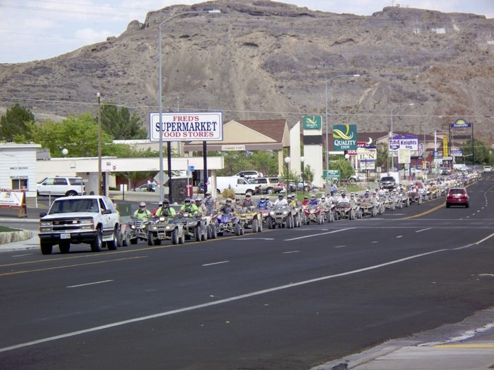
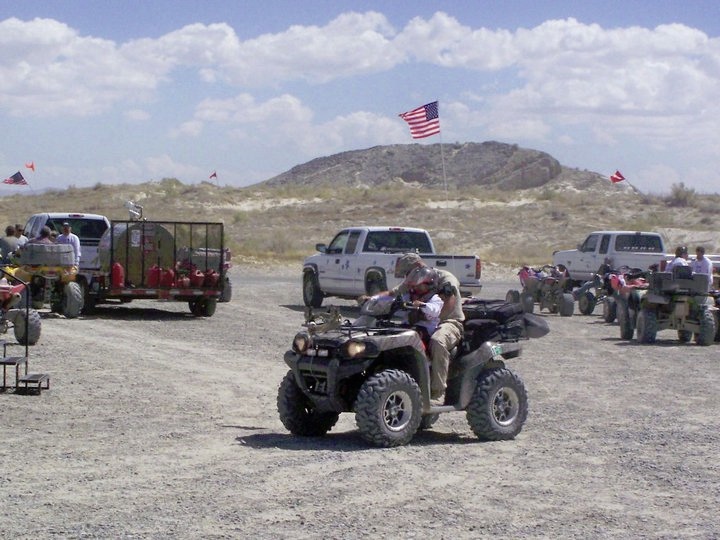
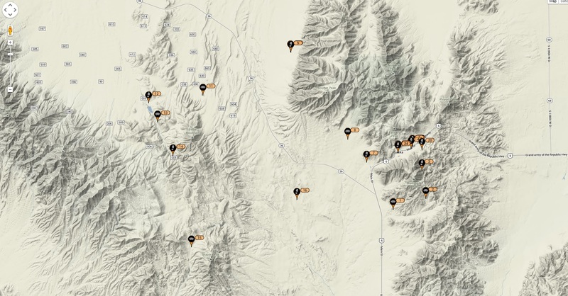
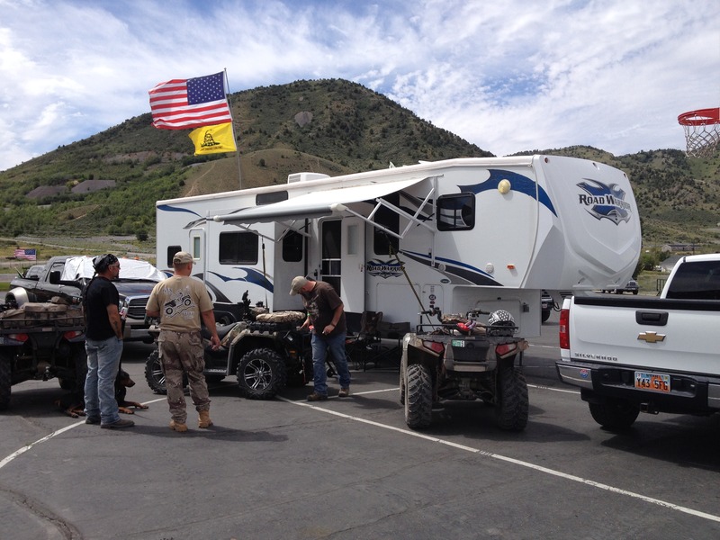
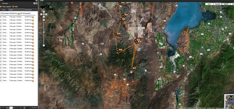
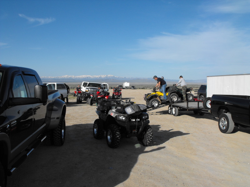
On Saturday at 0900, around 200 ATV's departed the Deseret Peak sports complex. Final destination, the Nugget Casino in Wendover, Nevada.

RFL1.jpg
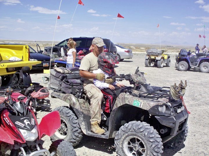
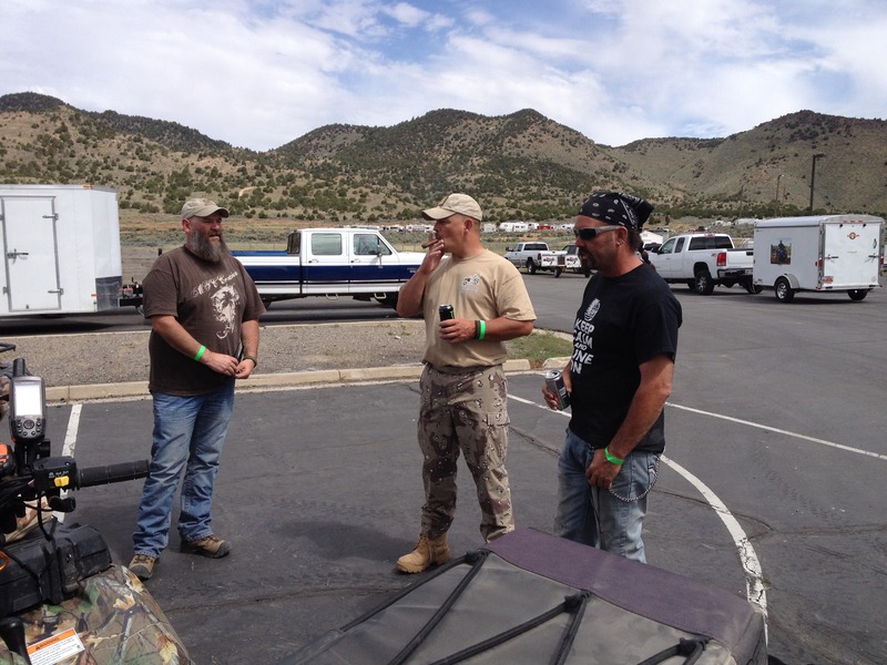
Interesting things to note about the event. In the end, over $24,000 was raised by this group and well over 100 people participated in the ride, with several dozen additional in support (trailering drinks, port-a-potties, extra trailers, etc). Ages ranged from late teens to folks in their 70's. Average speed for both days was easily 45-105mph (depending on the vehicle driven). My average speed was 53mph along the salt flats with top speeds exceeding 64mph.

RFL2.jpg
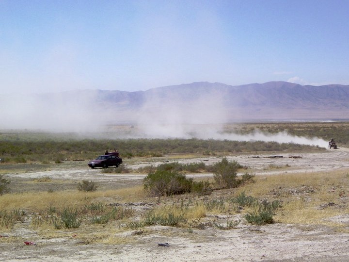
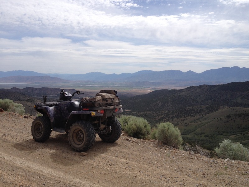
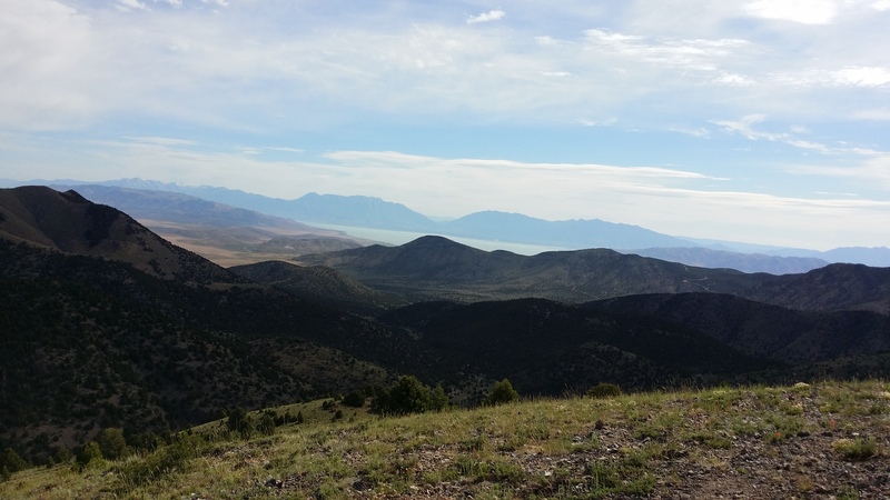
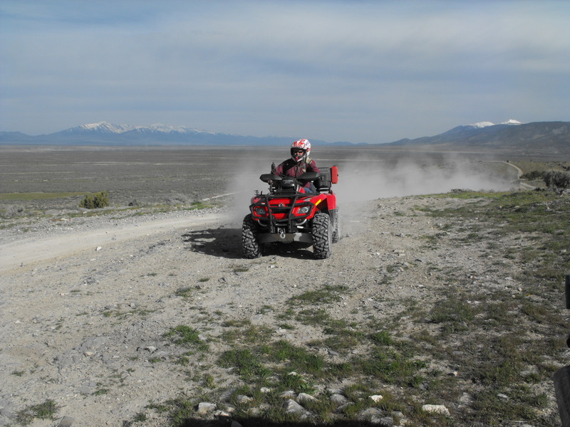
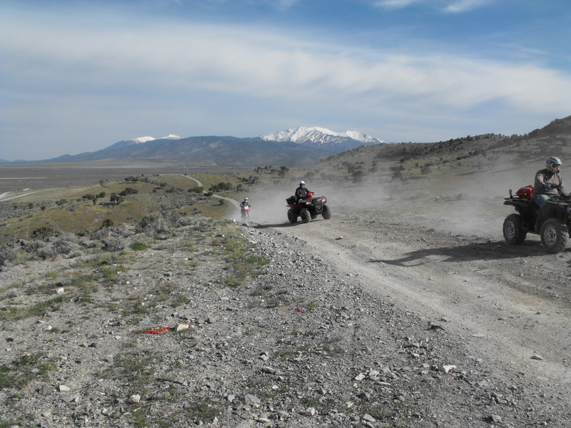
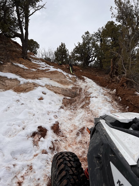
Virtually 100% of the terrain was flat open desert and the vast expanse of salt flats adjacent to the Great Salt Lake. Nothing overly challening except maintaining full throttle. Since the winds were excessive, we were able to avoid most of the clogging dust/dirt that usually accompanies 200+ machines going full throttle in the desert.

RFL3.jpg
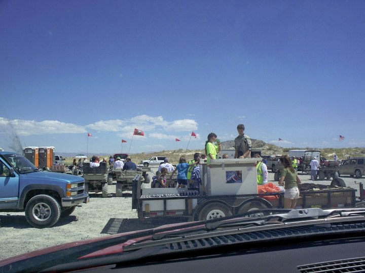
While en route, we took a break at the Knolls offroad area. After a few moments, one of the Make-a-Wish children (there were two brothers suffering from the same ailment) approached me in his wheel chair and said "you have the coolest and meanest looking machine out here, can you take me for a ride". We tossed an oversized helmet on his head and I had him start the machine. As soon as the engine fired, Noah hit the accelerator to the point of blowing the motor. Fortunately, we were still in Neutral.. that launch could have been disastrous.

RFL5.jpg
RFL6.jpg
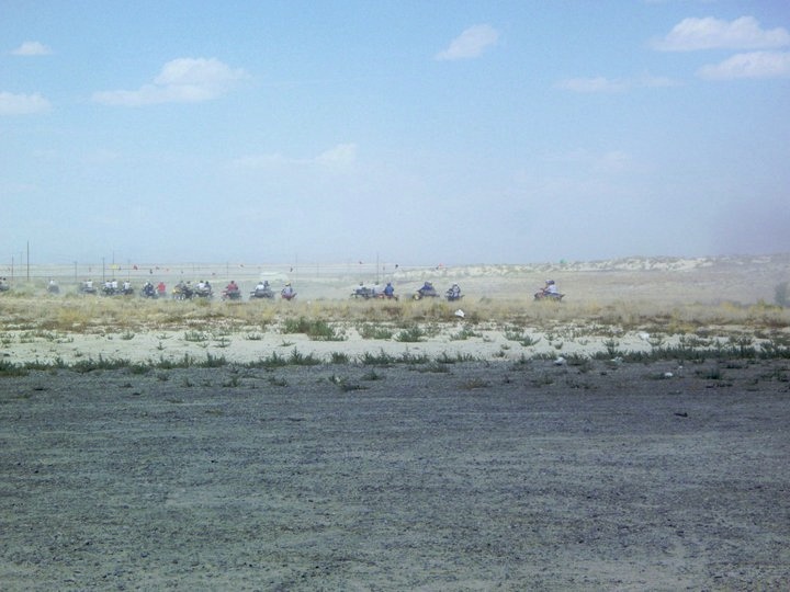
On the last 40 mile stretch before reaching Wendover, we hit the salt flats. Even though some machines were easily 1/4 mile ahead, they threw so much mud/salt in the air, it coated every inch of us. We had to stop to wipe our goggles every 2 or so miles, because it was impossible to see.

Reaching Wendover, we were escorted through town by several Tooele County search and rescue vehicles. Full lights and sirens. Tourists and passers-by stopped to gaze and photograph the long procession of machines coming into town. It was quite a sight.

RFL4.jpg
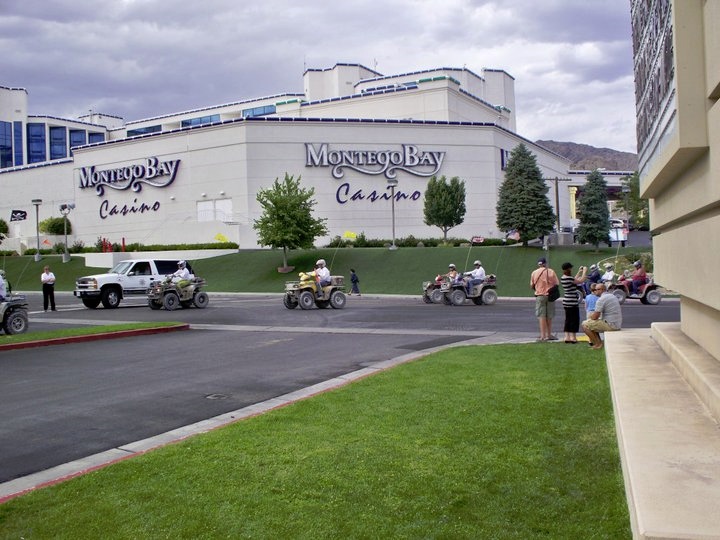
We then spent Saturday night donating our remaining money to the Nugget Steakhouse, slot machines and roulette tables.

Sunday morning was spent raffling off a ton of items donated by local companies, to include ATV ramps, ATV tires, medical supplies, first aid kits, fire extinguishers and the only 12V auto vacuum cleaner (which I won).

We preceeded back to Tooele on the same route, fortunately most of the previous day's rain had dried up and we didn't get nearly as salt coated on Sunday.

RFL7.jpg
Total mileage was around 185 miles. Total for the past week is now over 800 miles on my Kawasaki. What an August!


http://www.atvutah.com/cgi-bin/yabb2/YaBB.pl?num=1240693879/26#26

We went out again yesterday (Nick, Alex, Megan and I) to explore this hastily abandoned camp. Seems far more vandalism has taken place since last year.

Still a fun area to explore:

DSCF0184.JPG


DSCF0185.JPG

DSCF0187.JPG


A gopher snake that decided that if wanted to sit under my ATV:
DSCF0190.JPG

My older brother and younger sister came into town (at the same time). My brother was here to take a bit of time off and to help get my Durango running again, while my younger sister (only sister) was stopping by while en route to Zion National Park.

On Sunday, we went for a little ride to the North/East corner of Five Mile Pass. At that location, I thought I had destroyed the motor on my 2008 Kawi Brute Force 750i (400 miles on it so far) by hitting a large puddle too hard and ingesting water into the intake.

On Tuesday, we did an 86 mile loop from Five Mile Pass, through Eureka, around the Tintic Mountains and back. We all had a great time and many photos/videos were taken.

Follow along on our adventure:

North/East corner of Five Mile Pass, en route to the mud bowl:

CIMG1581.JPG


At the mud bowl, and ingesting water into the intake!
CIMG1588.JPG


Getting towed out by my 2005 BF 750i!
CIMG1590.JPG


Short video of the tow process:


Yet another perspective on the tow-operation:


It was quite sad to have my new machine grounded while my brother and brother-in-law continued to play in the puddle.

DSCF0011.JPGCIMG1650.JPGDSCF0009.JPG


From this point, I was towed back to my truck and got to hang out while I let everyone else do further trail riding and exploring. It was the end of my day.

The following Tuesday, I took the day off to again take my brother and two nieces on a long ride around the Tintic Mountains. I've done this ride several times already, but my brother was interested in a long ride with varying terrain and this was the perfect ride for that.

CIMG1626.JPG

Me prepping to lead the adventure:

CIMG1629.JPG


From this location, we circled around the mountains to the South of the staging area before proceeding toward the Tintic mountains. The weather was great. After all the rain and storms, there wasn't much dust, but there were still massive muddy puddles everywhere. In short time, we were all accumulating mud on everything.

Active mining area near Topliff:
CIMG1632.JPG

One of our first stops before circling around to the East side of Black Rock Canyon was the geocache named "Crappy place for a great cache"; easily one of the most unique geocaches I've ever found.

Me inspecting the "bowl"
CIMG1636.JPG


From there, everyone else was intrigued as well. What the "crap" was I doing they asked"?

CIMG1638.JPG


From here, we rode through Twelve Mile pass and started the ride up Black Rock Canyon from the East side. Not a single other person/ATV in sight. It was a beautful day.

<rant on> Half-way up the mouth of the canyon, I encountered a very scared Yellow Labrador that appeared to have been abandoned. He was too skittish of me, the machine and helmet to approach, but was definitely tired and hungry. I'm sickened by the amount of animals I find in the desert that are wantonly abandoned. </rant off>

Near the top of Black Rock Canyon (from the East side), there's a live stock watering hole. I'm not certain if this hole was incidental or man-made, but this is where we stopped for  a quick lunch.

CIMG1652.JPG


Here's a video showing the ride up to the watering hole:


From this point, we continued over the canyon to the West side and banked north toward the microwave towers overlooking Hwy6.

We stopped in Eureka for fuel, snacks and a brief break. While there, everyone enjoyed the Rockwell Cabin.

CIMG1667.JPG

CIMG1670.JPG


From this point, we proceeded up the canyon to the immediate West of Eureka and decided to ride to the top of Overlook Point.

A quick video on the ride up:


DSCF0033.JPG


DSCF0035.JPG

Staging was set for 0900-0930 on Saturday 16 May. Upon arrival, there were already several trucks unloading ATV's of all types. As it turned out, Chris Brimhall (aka Ghost Rider) had brought down most (if not all) of the Northern Utah ATV Club to ride the same route.

Just before 0930, m74me (Dennis) and Britt & Bill arrived. Just as we were leaving, another couple Edward and Rossalind asked to join our group.

At exactly 0930, we pushed out and began our (what would end up being 90 miles) ride.

The first obstacle was a mountain climb with significant rocks and obstacles on the way up. We broke out the winches, muscled the machines up and pressed on. No damage, no injuries. So far, so good.

Our first break came about 15 miles into it. We stopped near "Great Place for a Crappy Cache" and explained to Edward and Rossalind (who have never geocached) that there was a public toilet behind a tree. They couldn''t believe what they saw. A full sized toilet, right there in the open desert!

Britt & Bill looking to the South as 24+ ATV's from the Northern Utah Club came through:
DSCF0007.JPG


DSCF0009.JPGEdward and Rossalind coming back from the geocache "toilet":
DSCF0011.JPG
At this point, we banked East toward Black Rock Canyon and began winding our way up. Upon reaching a cattle watering hole, Dennis (m74me) determined that he had torn a 3/4" gas in the sidewall of a rear tire. It was to plug (for him), and time to place a geocache at this location (by me).

The group at a break near the watering hole:
DSCF0014.JPG
DSCF0016.JPG

Shortly after leaving the watering hole and about half-way through Black Rock Canyon, Edward hit a rut, and both he and Rossalind flew off the machine. Fortunately, neither seemed to be seriously injured, but they were obviously shaken up. Afterward, Edward drove much more modestly.

East cattle gate to Black Rock Canyon. Dennis aka m74me taking a break:
DSCF0017.JPG

From this point, we proceeded south along the Tintic mountains and decided to head into Eureka for food & fuel. Upon arrival, we found a full group of motorcyclists (at least 20+) and all 24 ATV's from the Northern Utah ATV club already there. The gas station attended seemed a bit overwhelmed.

The "group" near Rockwell's Cabin:
DSCF0019.JPG

After fueling up, having a snack, we decided to head back out via Chiulus pass. We were now a bit over 50 miles into our trip and the weather was perfect even though a bit warm.

We navigated through the Rock Garden and came down the pass into the canyon adjacent to Black Rock Canyon.

Edward and Rossalind coming out of the canyon:
DSCF0022.JPG


En route back to Five Mile Pass, we managed to leave Dennis behind. After getting the group safely back to the vehicles, Bill and I decided to go looking for Dennis. Fortunately, he had found his own way back.

Final mileage: 90 miles, end of ride: 1730. What a great day!

Britt, Bill, Dennis, Edward & Rossalind: If you're reading this and you have photos, please do share them.

DSCF0021.JPG

Start: N 40 14 10.79  W 112 09 43.12 (south side staging area)
Rock Crawling: N 40° 12.203 W 112° 09.607
Ridge line: N 40° 11.134 W 112° 08.738
Hill Climb:  N 40° 09.718 W 112° 09.490
12 Mile Pass:  N 40° 05.591 W 112° 09.896
Black Rock Canyon: N 40 02 44.66 W 112 09 14.17
Meadow Ride: N 40° 01.899 W 112° 11.519
Mill Canyon (if there's interest): N 40° 01.518 W 112° 13.984
High Point: N 40° 00.207 W 112° 11.815
Eureka Sinclair: N 39° 57.272 W 112° 07.197
Chiulus Pass: N 39° 57.363 W 112° 07.778
Rock Crawl: N 39° 58.224 W 112° 07.718
Allen Ranch Road: N 40° 02.137 W 112° 04.290

..then back toward Five Mile Pass.

Who's coming for the ride?
After riding 50+ miles through the Eureka/Tintic mountain areas yesterday, we loaded back up and rode up to the top of Jacob City. While we were able to reach the top, the entire ridge line is still covered in 2+' of snow.

I attempted to plow through anyway, but the snow was soft and my machine would only dig in.

So, for now, I'm postponing this ride until all the snow has cleared (for safety and to prevent rutting up the trail).

If anyone has interest, I'd be game in making another 50+ mile Tintic mountain ride. Black and Mill Canyons are now open and passable via ATV, but probably not yet for motorcycles.

A few photos from yesterday:

Craig (co-worker) and Danielle (sister-in-law) after coming back down from Mill Canyon (Craig's motorcyle couldn't make it up and he dumped it at least 3 times):
mill2 (1).JPG


mill2.jpg


These photos are from the top of the Jacob City area. I started at the staging area just off Ophir Canyon and Hwy 73:

OphirTop.jpg

OphirTop (1).JPG

OphirTop (3).JPG

Since early April, we've been attempting to get up Mill Canyon / N 40° 01.518 W 112° 13.984, but the snow has just been too deep, with some drifts being 3+ feet in depth.

My main goal was to attain a geocache (not yet found) that was placed in December 2008 by Britt & Bill.

Since I enjoy riding in Mill Canyon (it dead-ends in a nice steep hill), and we also enjoying looping from Five Mile Pass / N 40° 14.221 W 112° 09.845, around the Tintic mountains, through Eureka (for a soda and fuel), through Little Moab, into 12 Mile Pass and back to Five Mile, it just made sense that I would come back every couple weeks to attempt this trail.

For the past few weeks, snow was receding at about 500'/week, but it still put me to within .5 mile of the final location (just before the Dry Lake).

So yesterday, I loaded up the ATV, extra fuel and my snow shoes, hell-bent to get to this location.

I got to within .5 miles before getting stuck in a 4' snow bank (that draped from the mountain, over the trail and down the hill). I put on the snow shoes and started hiking East toward the geocache location. The snow was quite deep for about .25 miles until it cleared and just turned into thick mud.

Mill (4).JPG

Fortunately, the geocache was not buried in snow, but was placed in a perfect area to keep it dry and accessible. The cache description indicated a First-to-Find prize, and I got it! The FTF prize was either the $10 Sportsmans Warehouse gift-card or the first ever Britt&Bill Geo-Coin.

Mill (2).JPG

Mill.jpg


Other Links:


 Main
 Archives
 CMS
 Photos
 About/Contact
 Twitter @BruteForce
 Facebook
 LinkedIn
 Geocaching
 View DGP stats


My Audio & Video:


 Flickr
 YouTube
 Pandora


Elsewhere:


 ATV Utah
 Our ATV Obsession
 Bogley Outdoor Community
 UTAG
 ATV Escape
 Trish's Cake Shop
 Dennis Udink's Site
 Army Ranger
 Alex's World
 Grizzly Guy
 Adventure World TV
 WeatherCam: UofU


SPOT Locator:


 Where is James King?

September 2010

Sun Mon Tue Wed Thu Fri Sat
      1 2 3 4
5 6 7 8 9 10 11
12 13 14 15 16 17 18
19 20 21 22 23 24 25
26 27 28 29 30    

Recent Photos

  • RFL7.jpg
  • RFL4.jpg
  • RFL6.jpg
  • RFL5.jpg
  • RFL3.jpg
  • RFL2.jpg
  • RFL1.jpg
  • BigRide5.jpg
  • DSCF1014.JPG
  • DSCF1011.JPG

About this Archive

This page is an archive of recent entries in the Eureka category.

Events is the next category.

Find recent content on the main index or look in the archives to find all content.