Recently in Richfield Category

GPSr tracks found here: Fillmore-to-Salina-Richfield.gdb


On 10 June, my friend Aaron and I took off at 0630 AM en route to the Fillmore KOA. Our objective was to run the PST03 (Chalk Creek), up and over the mountain, dropping down into Aurora, then proceeding into Salina for lunch.

https://youtu.be/aexLGjA01tk


At elevation, temps were easily 55-60F, while in the low land of Salina, temps were low 90's. What a contrast in temperatures.


While up top, we decided to check out a little side trail named: Bear Hallow. What a nice run through wild flowers to a cattle pond at the base.


20170610_16292220170610_16302820170610_16334520170610_16560820170610_17112920170610_18281820170610_18282720170610_201419

Circleville to Panguitch and Back

| No Comments
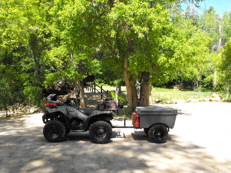
On Friday, 14 August and immediately after ending the work day, my youngest son (Nick, age 17) and I departed for Big Rock Candy Mountain in central Utah.

I had that very morning reserved a room at the BRCM Motel; a place I will likely not stay again. We had an outstanding supper at Hoovers (me: 18 oz Prime Rib, Nick: Burger w/Hoover fries).

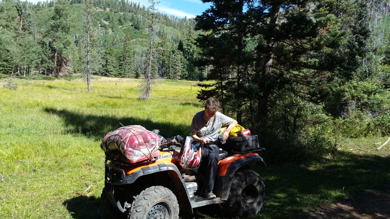
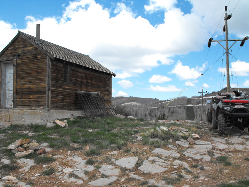
While sitting outside the motel enjoying a cigar, I approach a large group a few rooms over and we began discussing trails and riding options. It would seem at least one member of their group recognized me as he had my Facebook profile photo up on his phone.

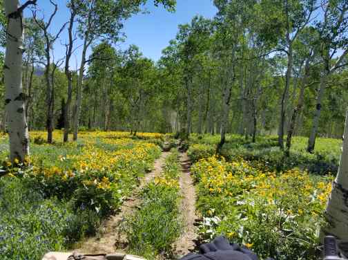
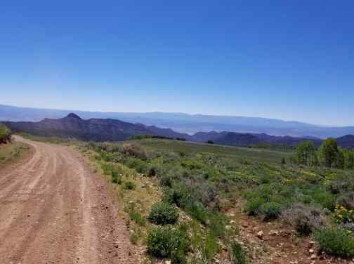
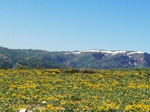
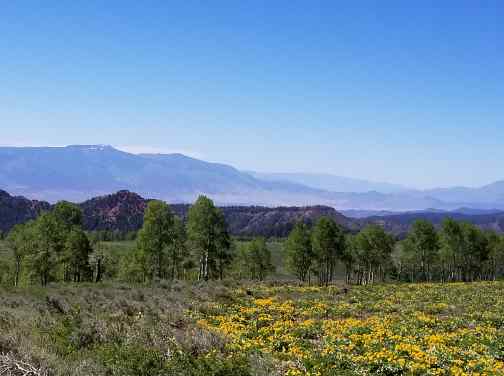
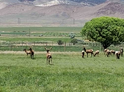
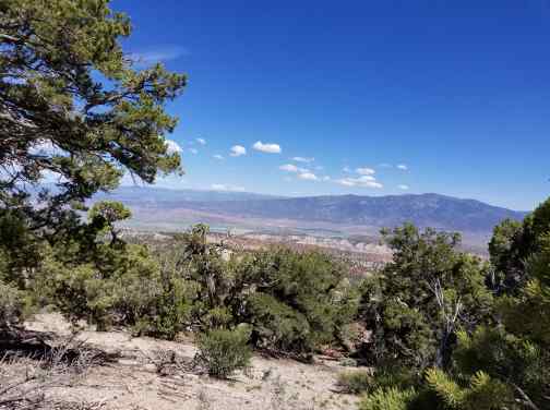
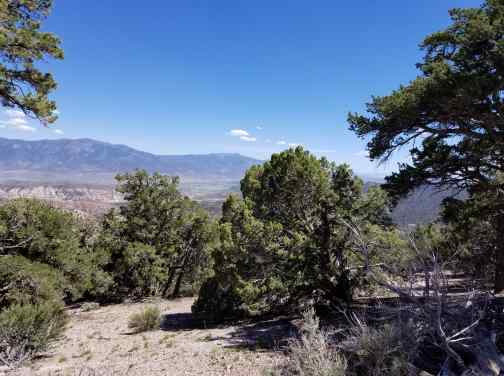
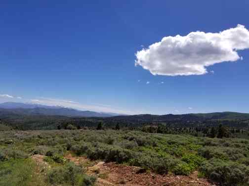
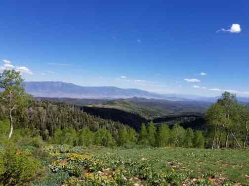
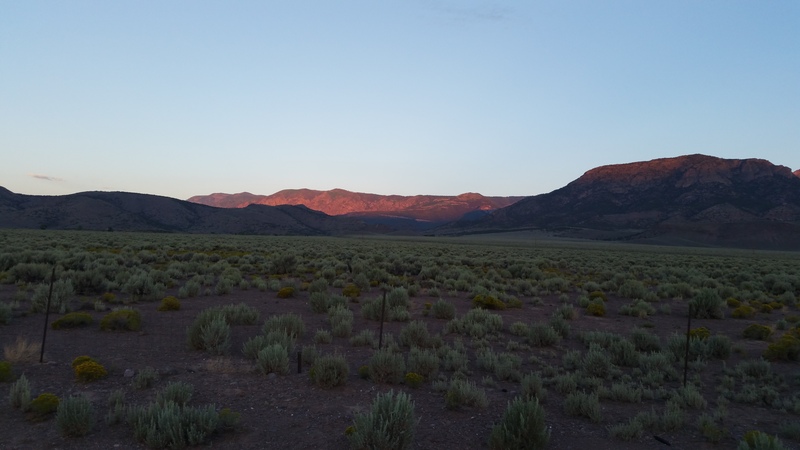
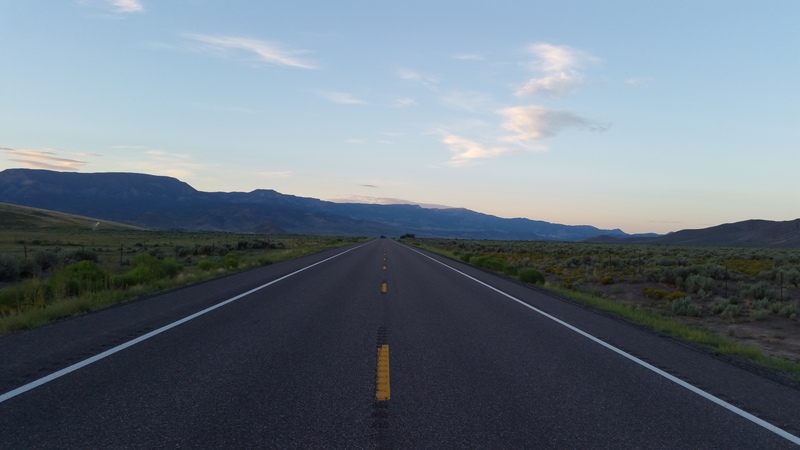
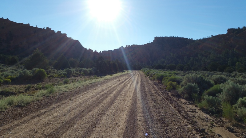
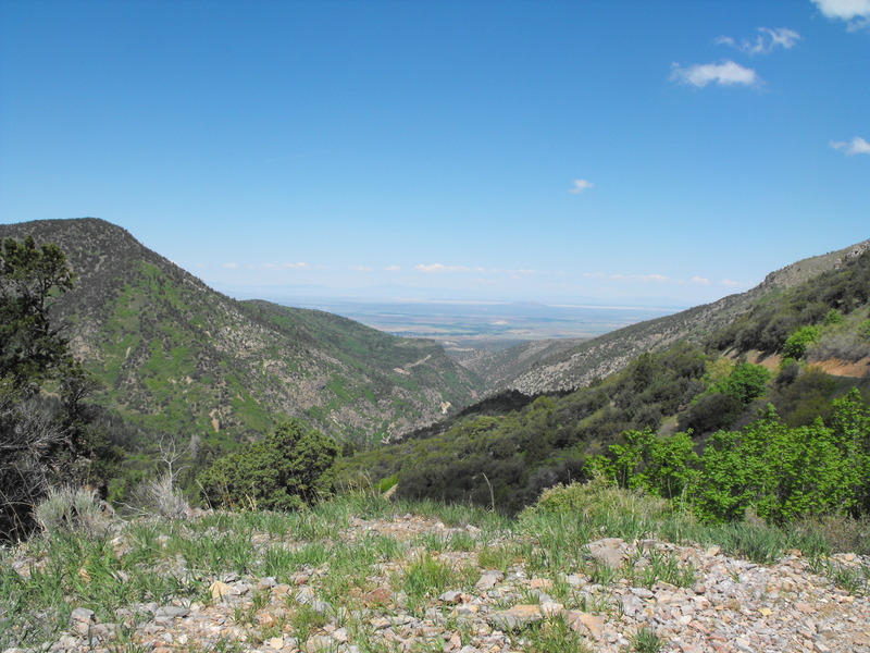
The following morning, we departed at 0730 to enjoy a quiet breakfast at Butch Cassidys in Circleville. We got there at exactly 0800 when the establishment opened. The waitress, a very nice lady with a thick New York accent went above and beyond, giving me two maps for the Markagunt and Panguitch Loop areas. Score! The drive into Circleville was  spectacular, with the sun just coming up over the mountains. With nobody on HWY89, I pulled to the side to take a few photos:

20150815_065135.jpg


20150815_065147.jpg
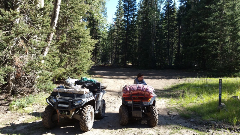
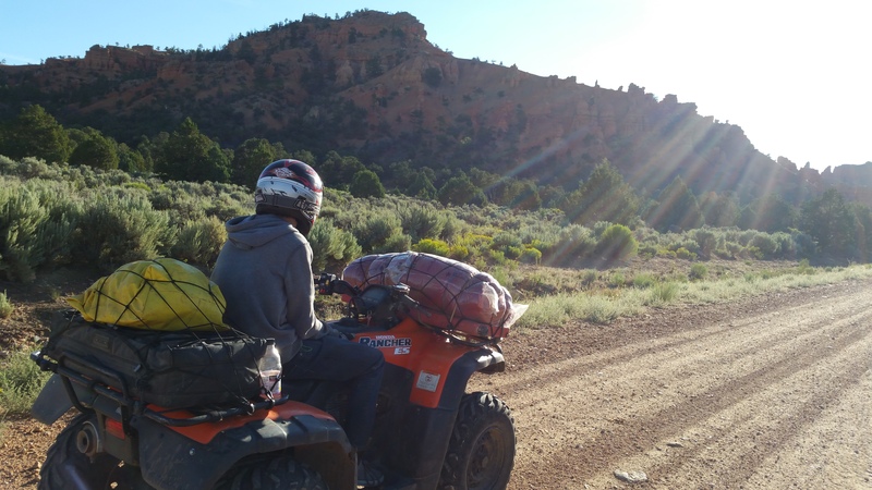
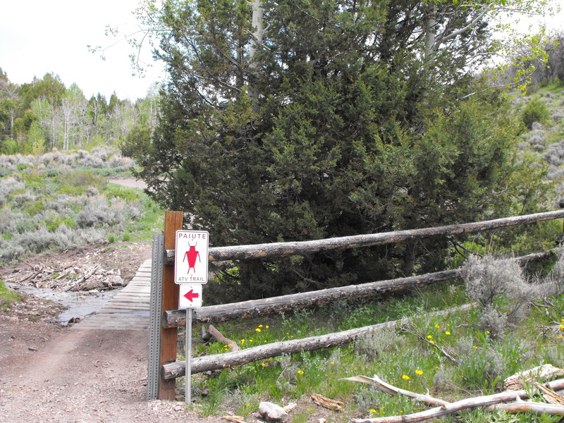
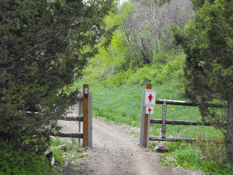
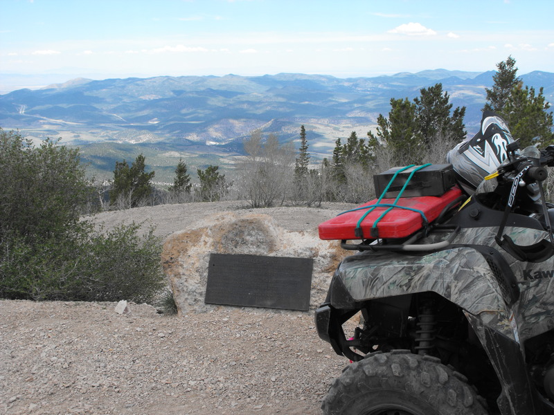
After concluding breakfast, we went straight up the mountain via the Paiute 01, destination: Panguitch!

20150815_100334.jpg
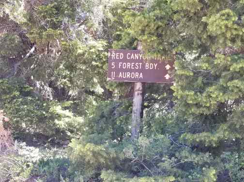
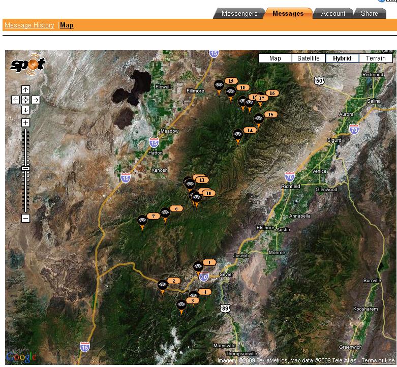
Trails covered were as follows:

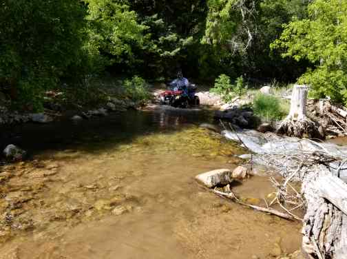
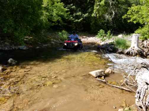
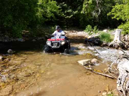
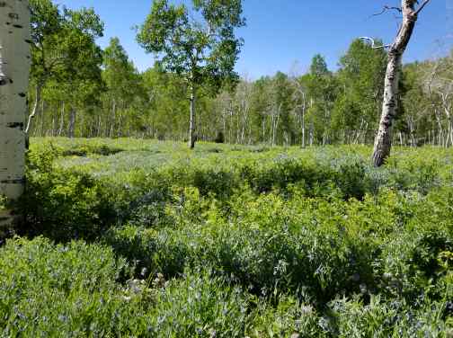
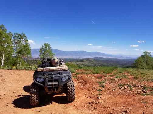
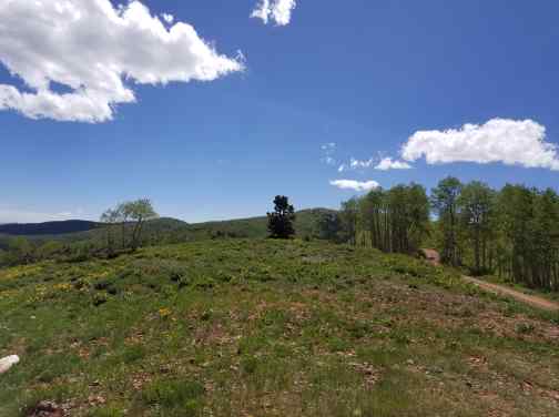
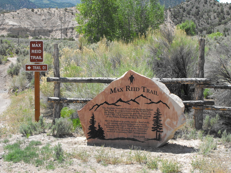
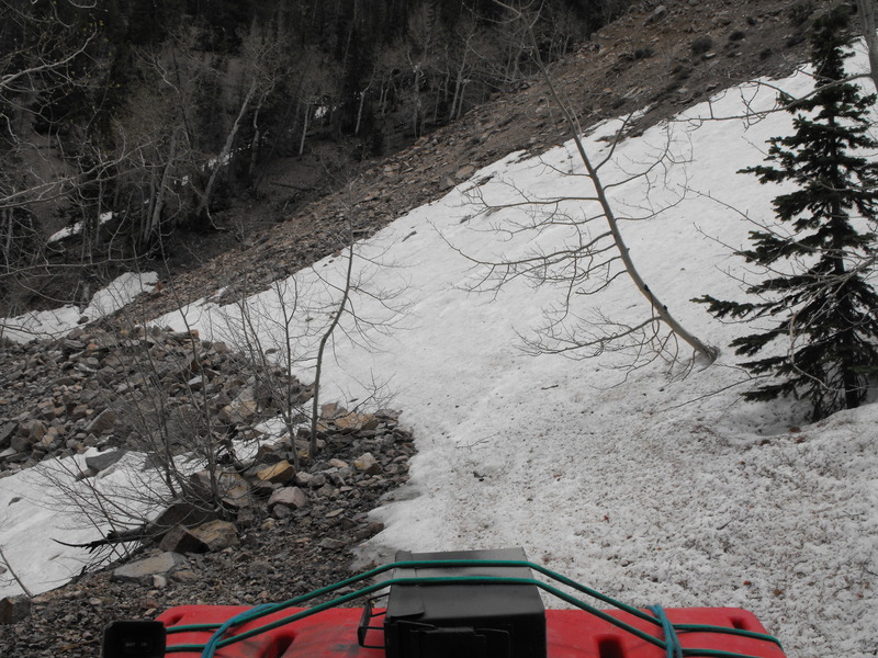
Paiute 01 --> Paiute 88 South --> Paiute 67 --> Paiute 68 West --> Markagunt trail system South --> cross HWY20 --> Markagunt 02 Trail East --> Unknown trails South and into Panguitch --> Casto Canyon --> Fremont 01 --> Fremont 02 --> Horse Valley/Canyon trail --> Circleville and back to the truck.

Untitled.jpg
Total mileage for the loop was just under 150 miles!

20150815_105125.jpg


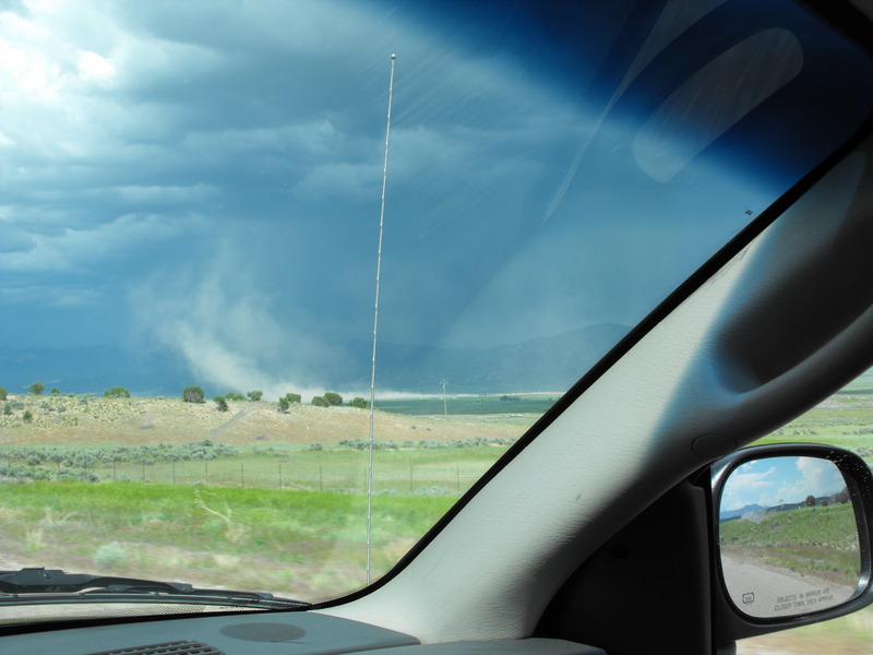
Within just seconds of coming off the Markagunt trail system and hitting asphalt into Panguitch, the sky opened up with rain, lightning & thunder. Our original plan was to fuel up and head into Casto Canyon to make camp (tent) there. Instead, we rolled across the street to "Church's Blue Pine Motel". On the outside, it looked sketchy, but to our delight, the rooms (we had 3 bed, 2 room + bathroom) was totally awesome and clean. It was now near 5pm and time for supper. Usually we'd go to the Cowboy smoke/steak house, but this time we walked next door to Foy's Country Corner restaurant. Nick was brave (or stupid) and ordered Teriyaki stir fry, while I just got a turkey sandwich.

Across the street, we saw the movie theater / ice cream store. Watch a movie while eating Ice Cream. Unfortunately, they only had two movies and neither was appealing, so we opted for ice cream alone.

After a fine cigar sitting outside the Motel room, we watched the sky light up with thunder, lightning and rain. We watched the tourists run about taking photos of virtually everything on Main street.

The following morning (Sunday), we decided to depart by around 0800. Not a cloud in the sky, the day was going to be perfect!

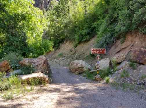
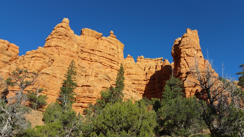
We ran main street / HWY89 to the Casto Canyon trailhead/turn-off and hit the dirt.

20150816_083053.jpg20150816_083059.jpg
Not too far into Casto Canyon, we decided to stop and make breakfast. I broke out my backpacking stove, old canteen cup and our favorite breakfast stuff + some awesome instant Filipino coffee.

20150816_084649.jpg
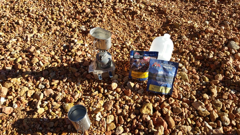
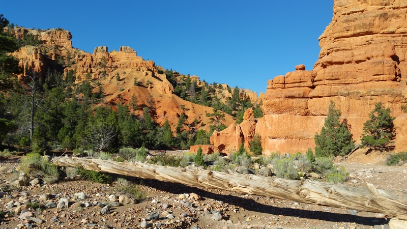
The rising sun and the reflection against the red/orange Hoodo's was breaktaking!

20150816_083905.jpg
20150816_083916.jpg20150816_085102.jpg


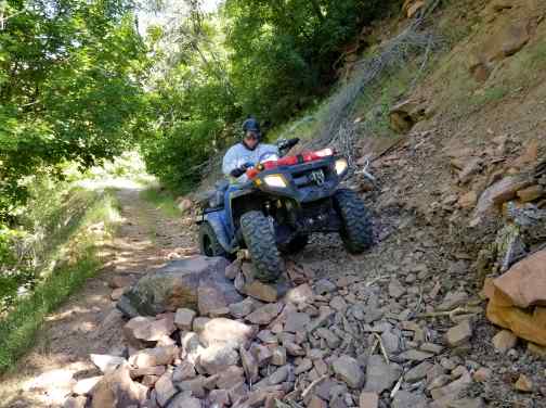
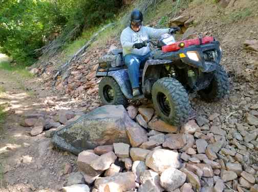
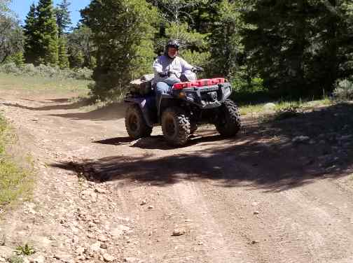
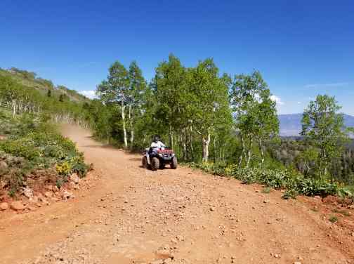
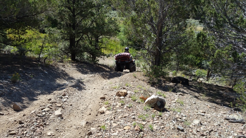
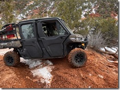
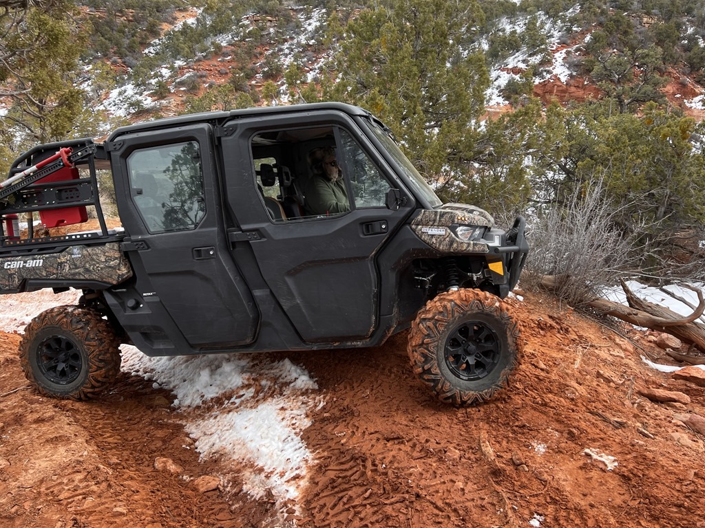
Slightly more than halfway through, I let Nick take point. I'm thinking he thought it was a race, he tore up the canyon so fast. At one point, he almost got his machine sideways:


At the 2:56 mark, you can see Nick almost get sideways!

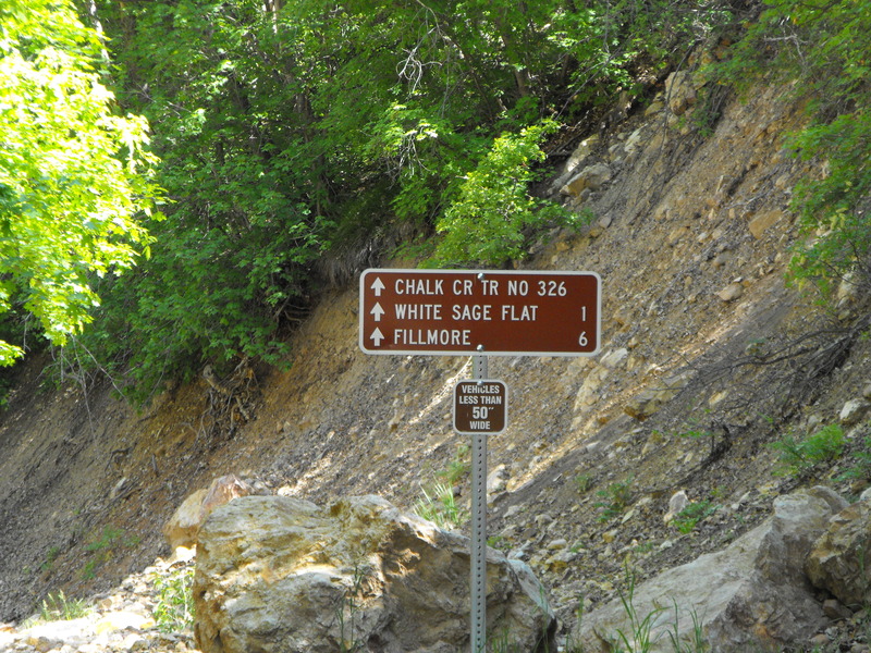
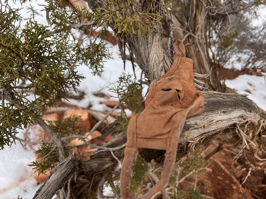
Sadly, Casto Canyon is only ~5 miles long. It is interesting to note that to enter, you must go through a super small 50" gate, but to exit at the North end, you have a ~60 inch or so wide gate. I'm wondering how many have entered from the North, only to find they can't exit the south side.

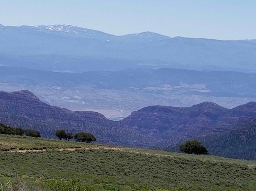
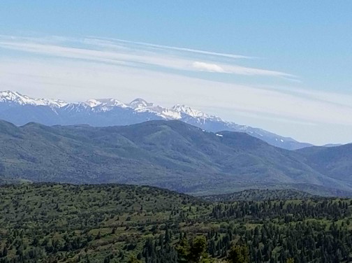
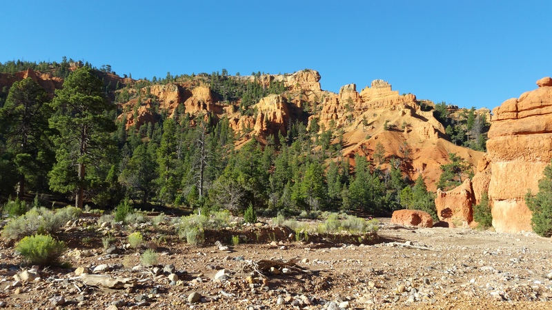
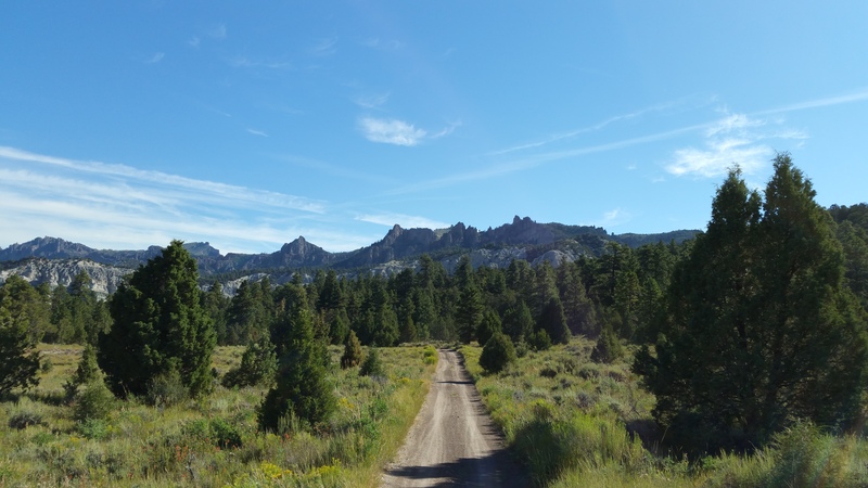
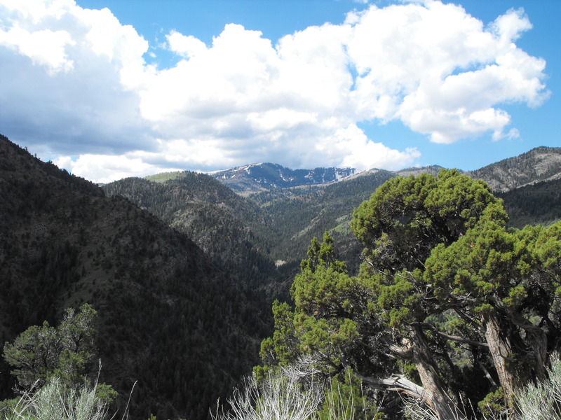
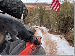
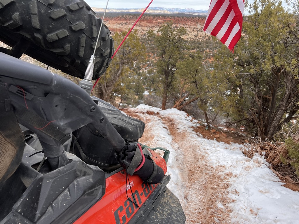
Onto the Fremont trail we continued. With the sky clear and cloudless, the scenery was just amazing.

20150816_095008.jpg

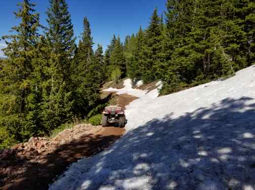
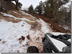
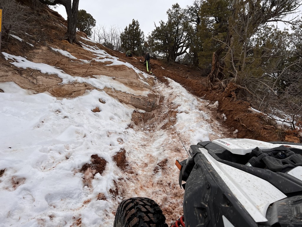
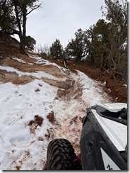
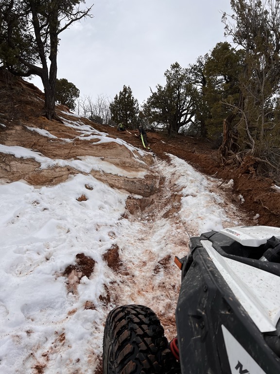
Somewhere along the trail, we encountered a slightly steep, loose gravel section that required me to tow Nick up. I tossed the winch cable underneath the machine, hooked up, put in 4WD/Low gear and up we went..

20150816_112615.jpg

What a fantastic weekend to share with my youngest son, Nick. It's looking favorable I'll do this trip again in late September when its a bit cooler out.

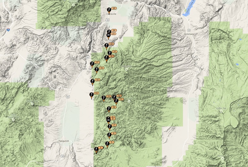
Garmin tracks for this trip found here:


3 Months of ATV Follies

| No Comments
Caution: Some language and gestural profanity involved in this movie.

This is a compilation of at least 3 rides that took place from Aug-November 2013, where the best goof-ups and oopsies occurred. 


ATV Follies III 2013 from Midnight Rider on Vimeo.

Enhanced by Zemanta

3+ Weeks on the trails

| No Comments

For the entire 2nd half of September and first half of October, I was fortunate enough to get in some camping, fishing, hiking and ATV'ing.


GPSr tracks found here:

5Mile-to-Eureka-via-BlackRock.gdb

Koosharem-to-Richfield.gdb

Kanosh-to-Marysvale.gdb

05 Oct 2012-Jacob City-Soldier Creek Ride.gdb

PaiuteTrail_BarneyLakeTrackLog.gpx


Koosharem-Marysvale-Riding


I spent the first 7 days between Koosharem, Utah and Marysvale, Utah. My goal was to ride as many "new-to-me" trails as possible while in those areas, with an emphasis on filming and riding the much-touted Barney Lake trail.


The first four days were spent at the Koosharem RV park; a small park that can host approximately 10 RV's. I was quite surprised that I was able to get my massive rolling Marriot into their park.


Day 1, I found myself wanting to go fishing at Otter Creek reservoir. Sadly, the lake was at 50% of its normal water capacity, and I was able to drive my truck across a sand bar that placed me about where the middle of the lake used to be.


DSCF8068DSCF8069DSCF8070DSCF8071DSCF8072


With the water as low as it was, I was unsuccessful, but I did still manage to net about a dozen crayfish and boiled them up for dinner that evening (along with a great steak!).


Day 2, and my friend Gary Elias (and wife) arrived to join me. After getting his camp setup, we thought we'd make the ~80 mile round trip to Otter Creek and back. Unfortunately, Gary's diabetes were acting up and we changed course, instead heading toward Monroe.


DSCN0341DSCN0342DSCN0343DSCN0344DSCN0345DSCN0346DSCN0347DSCN0348DSCN0349DSCN0350DSCN0351DSCN0352DSCN0353DSCN0354DSCN0355


While leaving Monroe and heading back toward the trails, we saw a couple towing the most interesting camper (with their ATV) that I've ever seen.


DSCN0356DSCN0357


Day 3, we decided that we'd make a run at the Barney Lake trail. This trail was known for being brutally steep, rock covered and for advanced riders; it really didn't seem to be any of those (to me), but did have a few decent technical sections.


Barney Lake trail


DSCN0365DSCN0366DSCN0367DSCN0368DSCN0369DSCN0370DSCN0371DSCN0372DSCN0373DSCN0374DSCN0375DSCN0376DSCN0377DSCN0378DSCN0379DSCN0380DSCN0381DSCN0382DSCN0383

My favorite trail though had to be the PST65 coming off Monroe Mountain and into the town of Monroe. This trail had tight switchbacks, some interesting terrain and a descent of over 7000' in elevation.


PST65


On Day 4, I said my goodbyes to Gary and his wife and departed for Marysvale. I had already phoned ahead and reserved a spot at Lizzie -n- Charlies RV park (easily my favorite RV park in central Utah).


From this location, I rode the Deer Creek 74 trail, the 606, Barney Lake (yet again) and the PST 65 (yet again).


PST606


After ~7 days, it was time to return home. Fortunately, for me, another friend contacted me and asked if I wanted to join him in riding from Kanosh to Marysvale (as a day trip). This ride is easily my annual favorite, so I gladly accepted and we departed for the Adelaide campground.


Kanosh-to-Marysvale


The PST97 "Al Gay" trail and Paiute 01 were our primary destination trails, and neither disappointed.


PST97


Sam Stowe


What a great time on the Paiute in September!


So, I'm back home, interviewing for new jobs and trying to find additional trails to ride. Again, the phone rings and my brother-in-law is wondering if I'd take him and his wife riding from Five Mile Pass to Eureka. Sure, I reply - so we head off to the Five Mile Pass area and enjoy a day of riding. Sadly, somewhere en route to / from Eureka, I managed to lose the keys to my truck. Fortunately, I have an awesome wife and she agreed to drive the 45 minutes to drop off my spare (and only remaining) set of keys.


The Snake Charmer trail @ Five Mile Pass


A week or so passes and I again get invited to ride the Jacob City Loop (Ophir, Utah area) with a new friend. We stage on Mercur Canyon road and depart for my secret trail on the south side of Ophir Canyon.


Jacob City Loop


Now, its almost mid-October and again I meet up with another new friend and we ride Little Moab to Eureka. We ride through (from East to West) Black Rock Canyon, then through Chilius Pass and into Eureka for lunch at the HWY6 Deli.


DSCN0417DSCN0418DSCN0419DSCN0420


The best section of trail riding in this area is the Dry Lake, Mill Canyon trail. This trail is easily the most technical ride in the entire area.


Mill Canyon


So, its now the 12th of October and I'm prepping for 10 days in the San Rafael Swell, White Sands and Moab. That trip report will be posted later.

Enhanced by Zemanta

In early May 2010, my brother, youngest son (Nick) and his friend (Alex) all took off for Fillmore. We brought our rolling Marriott to stage at the Fillmore KOA.


Garmin tracks for this route:
Fillmore-To-Beaver.gdb

DSCF0373

DSCF0064DSCF0065

The weather was moderate with temperatures in the high 50's and lower 70's. Our plan was to ride (and camp) from Fillmore to Beaver, stopping for food and fuel along the trail.


Rather than my normal route through Meadow and Kanosh, we decided to head out via Chalk Creek, exploring many side trails along the way. Water levels in the creek were moderate.


DSCF0066DSCF0067DSCF0068DSCF0069


By the end of Day 1, we had already crossed I-70 and staged our camp  just between the Paiute 01 and 02 trails at about 10,000' elevation. Unfortunately, a massive storm blew in soaking everything. Fortunately, our little camp was well prepared to last through the storm.

Before getting too far toward Marysvale, we stopped at our favorite hole-in-the-wall restaurant (Hoovers) and enjoyed an excellent meal.

DSCF0413DSCF0414

DSCF0415

Nick made a bet that he could finish an 1 pound slice of chocolate cake. Needless to say, we didn't allow him to complete that bet.

Off to Marysvale we went.

DSCF0084DSCF0085DSCF0087DSCF0086

We awoke the next morning, broke camp and headed into Marysvale for food and fuel. Next stop was somewhere near Beaver and the lakes above the mountain. First though, it was a nice jaunt through Delano Peak and Big John Flat.

DSCF0089DSCF0090DSCF0095DSCF0097

DSCF0103DSCF0102

DSCF0437DSCF0439


We found a few lakes about 15 miles south of Big John Flat and decided to make camp again. Fortunately, we had planned ahead and brought our fishing gear. Unfortunately, the fish weren't biting, so we just enjoyed the day.

DSCF0105DSCF0106DSCF0107

For the return leg, we definitely wanted to hit the Max Reid and Paiute 76 trails. Toward the end of the 76 trail, we encountered a washed out section of trail and had to build it up with rocks to make it safely passable.

DSCF0112DSCF0109

Moments after reinforcing the drop-off, another group approached from behind and we gladly helped them down the 4' drop-off - were they ever grateful!

DSCF0113DSCF0114

DSCF0115DSCF0468

Most of the way through the Max Reid trail, we stopped to climb my favorite spot. I went up first to stage a rope so the boys could have a safety line.

DSCF0390DSCF0410DSCF0412


All in all, this was a fantastic way to spend 3-4 days with family! For Sept 2011, we're planning something similar, but in a new and interesting location near Casto Canyon.


Enhanced by Zemanta

Tent, food and at least an extra 5gal. fuel required. We will cross two mountain ranges, hit elevations in excess of 12,000', encounter all manner of wildlife and have an awesome time. Who's coming along? You will need an ATV of 50" or less width.


Fillmore to Marysvale (or further).


So after returning from a family RV road trip to Seattle (2000 miles), I packed up my 2005 BF 750i (the 2008 is still in the shop for ball joint/idler arm replacement), the ATV Tent/Trailer and drove out to Fillmore.

This was going to be my first Chalk Creek crossing pulling a trailer. I was worried that the extra weight would pull me down the creek, or worse - flood over the top of the trailer. No issue. The trailer pulled nicely through the deep and fast moving creek.

DSCF0020.JPG


From this point, I inspected (after searching for 10 minutes) my geocache location just off the creek and continued toward Copley's Cove. Considering it was a Wednesday, there wasn't another person to be seen during any of the trail riding.

Getting to Copley's Cove proved to be quite challenging. The route to this camp ground requires at least 6 creek crossings, two of which almost drowned the machine and trailer. One location had the water almost to the air intake and I could hear the machine sputtering while I hoped desperately that I had not ingested water into the machine.

Copley's Cove:
DSCF0023.JPG

Campground at Copley's Cove:
DSCF0026.JPG


From this spot, after again (3 years in a row) searching (in vain) for a geocache at this location, I continued Eastward and toward the top of the mountain.

Mid-way up, I rounded a corner and encountered three badgers in the middle of the trail. I stopped a good 10' from the enraged animals and watched them challenge me to a fight. One of the badgers was on his hind legs in a clear "legs get it on" stance. I pulled my 9mm, yelled loudly for the animal to move on and was glad to not have to shoot one of these fierce creatures.

Starting from the bottom, the temperatures were quite warm - easily over 80 with minimal cloud cover. As I climbed higher, I encountered snow banks and a good 20-30F decrease in temperature. The views were fantastic.

DSCF0027.JPG

DSCF0028.JPG


Upon reaching the the trail junction, the snow drifts became deeper and longer. About 30' from the top and junction to the 01 Pauite trail, the snow was too deep and the trail impassable. Bummer! The consolation prize was the interesting cabin (hunting cabin?) that was found up top that was open and contained various cooking utensils and an empty bunk.

DSCF0035.JPG


Alas, I had to turn around and ride the 30 or so miles back into Fillmore. Mid-way down, I hit a few rocks, got my trailer up on its side and it rolled (after disconnecting from the hitch). It was at this point, I discovered that a Fosters Lager beer can doesn't take to being thrown around in the cooler and found that it had detonated inside the trailer, soaking everything in beer.

I made it back to my truck, loaded everything back up and proceeded South toward the Fremont Indian Museum area, staging right next to the Max Reid memorial (Paiute 01 trail head).

DSCF0041.JPG


I bagged the geocache that was placed in honor of Max Reid (about 15' behind the marker) and proceeded to ride one of my favorite trails in this area.

The creek crossings are awesome up here, especially now that they've been protected by the new concrete crossings (installed last year). I continued up to the lower junction of what used to be named the Joe Lott trail and hid a geocache (can you spot it)?

DSCF0042.JPG

DSCF0043.JPG


From this location, I attempted to ride up the new 606 trail, but about 1.5 miles into the climb, I encountered a giant snow bank and rock slide -- blocking the entire trail.

DSCF0044.JPG


Once again, I had to turn around and ride back. I proceeded to ride up to the Winkler Point plaque and enjoy the views from that high vantage point:

DSCF0046.JPG

DSCF0048.JPG


After now riding for just under 200 miles, I was ready to call it quits, so I rode back to the truck, spoke with a few ATV'ers from California and headed home.

On the way home, a major thunderstorm kicked in and what appeared to be a funnel cloud touched down just south of Nephi. My truck went from 17mpg to 11mpg in a short 5 mile stretch of I-15 as I battled the heavy winds.

DSCF0052.JPG


All in all, a great time, great location and weather.

MayRide.JPG

Garmin Tracks for this route: Fillmore-To-Beaver.gdb

Enhanced by Zemanta


 Where is James King?


Language Translation


Other Links:


 Main
 Public Trail Maps
 Archives
 CMS
 About/Contact
 Twitter @BruteForce
 Facebook
 LinkedIn
 Geocaching
 View DGP stats


My Audio & Video:


 Flickr
 YouTube
 Pandora


Elsewhere:


 ATV Utah
 Our ATV Obsession
 Bogley Outdoor Community
 ATV Escape
 Trish's Cake Shop
 Dennis Udink's Site
 Army Ranger
 Alex's World
 Grizzly Guy
 Adventure World TV
 WeatherCam: UofU
 Delta Bravo Sierra Comics  
 PowerPoint Ranger Comics
 Reversaroller ATV Winch

March 2022

Sun Mon Tue Wed Thu Fri Sat
    1 2 3 4 5
6 7 8 9 10 11 12
13 14 15 16 17 18 19
20 21 22 23 24 25 26
27 28 29 30 31    

Recent Photos

About this Archive

This page is an archive of recent entries in the Richfield category.

Moab is the previous category.

San Rafael Swell is the next category.

Find recent content on the main index or look in the archives to find all content.