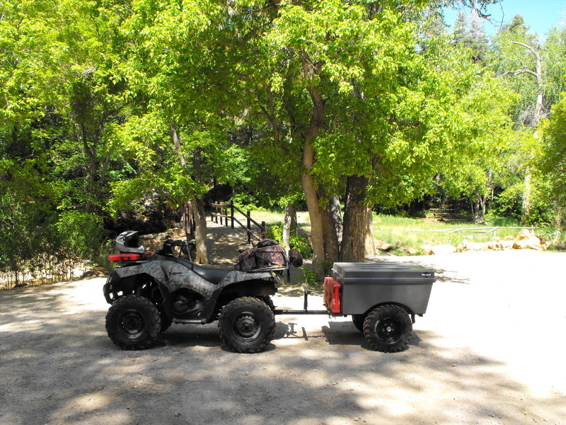
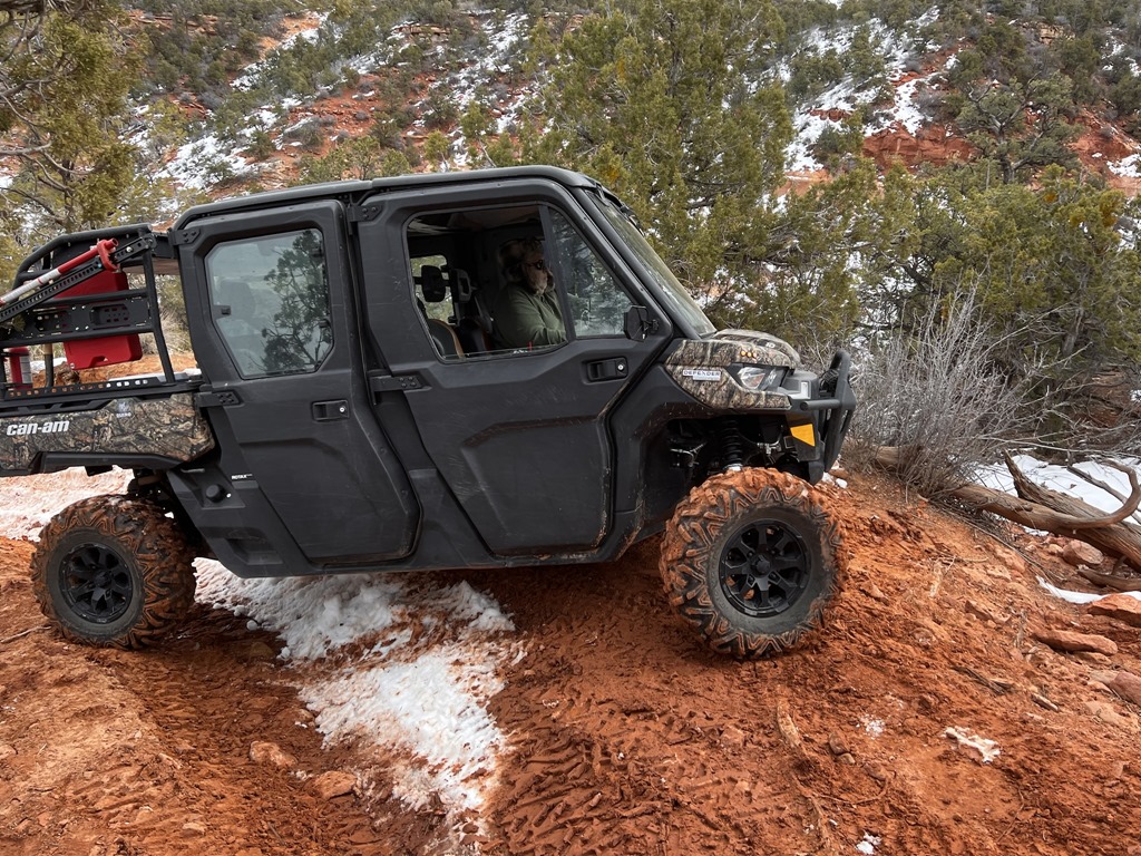
So after returning from a family RV road trip to Seattle (2000 miles), I packed up my 2005 BF 750i (the 2008 is still in the shop for ball joint/idler arm replacement), the ATV Tent/Trailer and drove out to Fillmore.
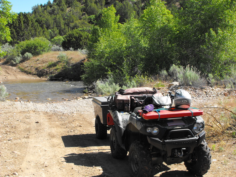
This was going to be my first Chalk Creek crossing pulling a trailer. I was worried that the extra weight would pull me down the creek, or worse - flood over the top of the trailer. No issue. The trailer pulled nicely through the deep and fast moving creek.
From this point, I inspected (after searching for 10 minutes) my geocache location just off the creek and continued toward Copley's Cove. Considering it was a Wednesday, there wasn't another person to be seen during any of the trail riding.
Getting to Copley's Cove proved to be quite challenging. The route to this camp ground requires at least 6 creek crossings, two of which almost drowned the machine and trailer. One location had the water almost to the air intake and I could hear the machine sputtering while I hoped desperately that I had not ingested water into the machine.
Copley's Cove:
Campground at Copley's Cove:
From this spot, after again (3 years in a row) searching (in vain) for a geocache at this location, I continued Eastward and toward the top of the mountain.
Mid-way up, I rounded a corner and encountered three badgers in the middle of the trail. I stopped a good 10' from the enraged animals and watched them challenge me to a fight. One of the badgers was on his hind legs in a clear "legs get it on" stance. I pulled my 9mm, yelled loudly for the animal to move on and was glad to not have to shoot one of these fierce creatures.
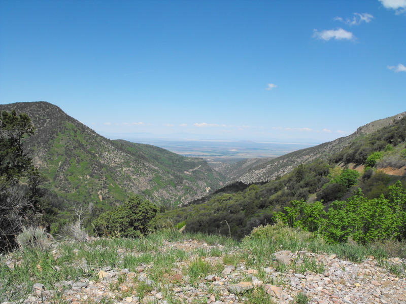
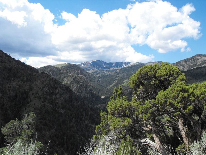
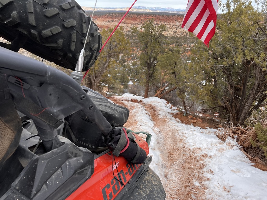
Starting from the bottom, the temperatures were quite warm - easily over 80 with minimal cloud cover. As I climbed higher, I encountered snow banks and a good 20-30F decrease in temperature. The views were fantastic.
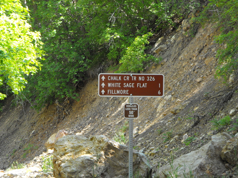
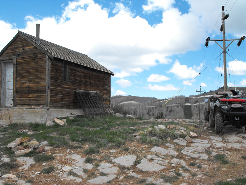
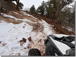
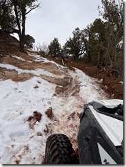
Upon reaching the the trail junction, the snow drifts became deeper and longer. About 30' from the top and junction to the 01 Pauite trail, the snow was too deep and the trail impassable. Bummer! The consolation prize was the interesting cabin (hunting cabin?) that was found up top that was open and contained various cooking utensils and an empty bunk.
Alas, I had to turn around and ride the 30 or so miles back into Fillmore. Mid-way down, I hit a few rocks, got my trailer up on its side and it rolled (after disconnecting from the hitch). It was at this point, I discovered that a Fosters Lager beer can doesn't take to being thrown around in the cooler and found that it had detonated inside the trailer, soaking everything in beer.
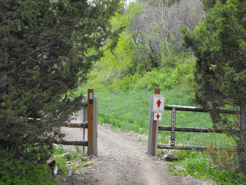
I made it back to my truck, loaded everything back up and proceeded South toward the Fremont Indian Museum area, staging right next to the Max Reid memorial (Paiute 01 trail head).
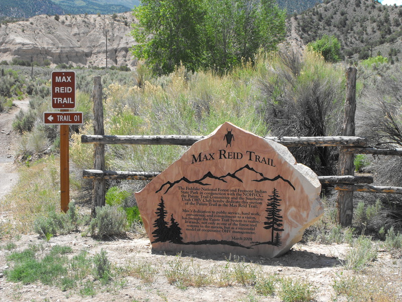
I bagged the geocache that was placed in honor of Max Reid (about 15' behind the marker) and proceeded to ride one of my favorite trails in this area.
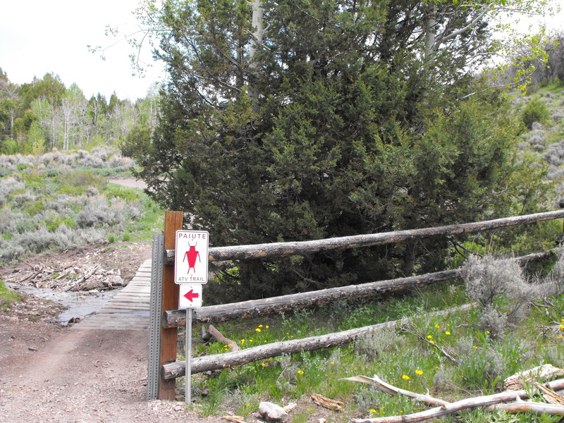
The creek crossings are awesome up here, especially now that they've been protected by the new concrete crossings (installed last year). I continued up to the lower junction of what used to be named the Joe Lott trail and hid a geocache (can you spot it)?
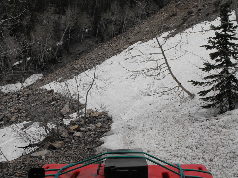
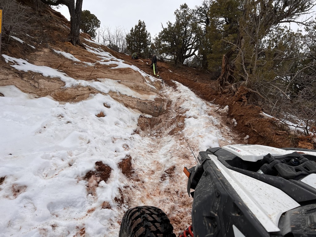
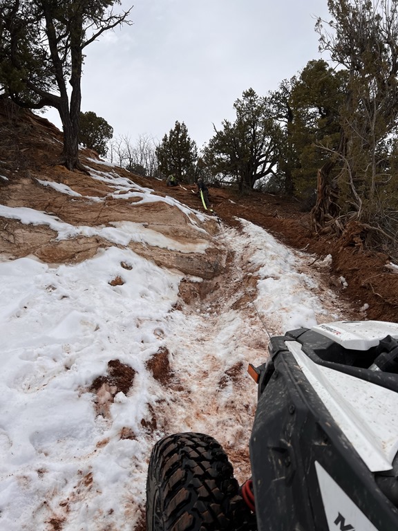
From this location, I attempted to ride up the new 606 trail, but about 1.5 miles into the climb, I encountered a giant snow bank and rock slide -- blocking the entire trail.
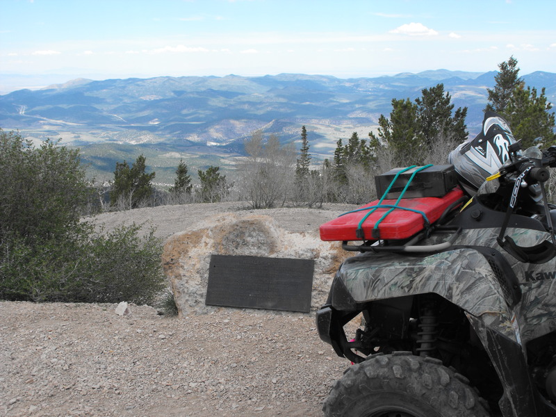
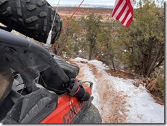
Once again, I had to turn around and ride back. I proceeded to ride up to the Winkler Point plaque and enjoy the views from that high vantage point:
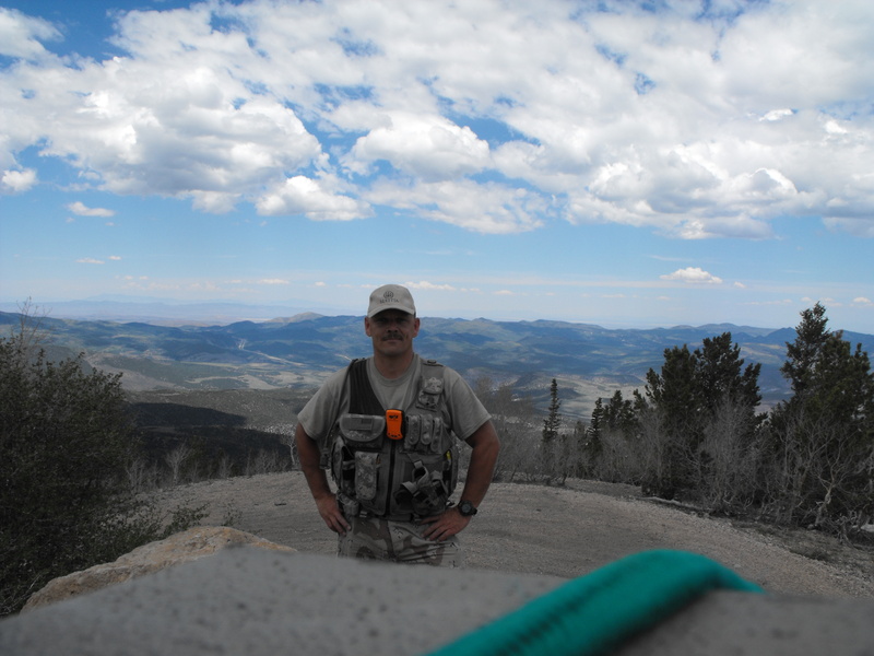
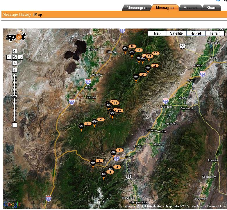
After now riding for just under 200 miles, I was ready to call it quits, so I rode back to the truck, spoke with a few ATV'ers from California and headed home.
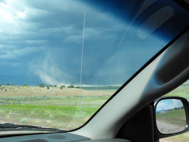
On the way home, a major thunderstorm kicked in and what appeared to be a funnel cloud touched down just south of Nephi. My truck went from 17mpg to 11mpg in a short 5 mile stretch of I-15 as I battled the heavy winds.
All in all, a great time, great location and weather.

This was going to be my first Chalk Creek crossing pulling a trailer. I was worried that the extra weight would pull me down the creek, or worse - flood over the top of the trailer. No issue. The trailer pulled nicely through the deep and fast moving creek.
From this point, I inspected (after searching for 10 minutes) my geocache location just off the creek and continued toward Copley's Cove. Considering it was a Wednesday, there wasn't another person to be seen during any of the trail riding.
Getting to Copley's Cove proved to be quite challenging. The route to this camp ground requires at least 6 creek crossings, two of which almost drowned the machine and trailer. One location had the water almost to the air intake and I could hear the machine sputtering while I hoped desperately that I had not ingested water into the machine.
Copley's Cove:
Campground at Copley's Cove:
From this spot, after again (3 years in a row) searching (in vain) for a geocache at this location, I continued Eastward and toward the top of the mountain.
Mid-way up, I rounded a corner and encountered three badgers in the middle of the trail. I stopped a good 10' from the enraged animals and watched them challenge me to a fight. One of the badgers was on his hind legs in a clear "legs get it on" stance. I pulled my 9mm, yelled loudly for the animal to move on and was glad to not have to shoot one of these fierce creatures.
Starting from the bottom, the temperatures were quite warm - easily over 80 with minimal cloud cover. As I climbed higher, I encountered snow banks and a good 20-30F decrease in temperature. The views were fantastic.
Upon reaching the the trail junction, the snow drifts became deeper and longer. About 30' from the top and junction to the 01 Pauite trail, the snow was too deep and the trail impassable. Bummer! The consolation prize was the interesting cabin (hunting cabin?) that was found up top that was open and contained various cooking utensils and an empty bunk.
Alas, I had to turn around and ride the 30 or so miles back into Fillmore. Mid-way down, I hit a few rocks, got my trailer up on its side and it rolled (after disconnecting from the hitch). It was at this point, I discovered that a Fosters Lager beer can doesn't take to being thrown around in the cooler and found that it had detonated inside the trailer, soaking everything in beer.
I made it back to my truck, loaded everything back up and proceeded South toward the Fremont Indian Museum area, staging right next to the Max Reid memorial (Paiute 01 trail head).
I bagged the geocache that was placed in honor of Max Reid (about 15' behind the marker) and proceeded to ride one of my favorite trails in this area.
The creek crossings are awesome up here, especially now that they've been protected by the new concrete crossings (installed last year). I continued up to the lower junction of what used to be named the Joe Lott trail and hid a geocache (can you spot it)?
From this location, I attempted to ride up the new 606 trail, but about 1.5 miles into the climb, I encountered a giant snow bank and rock slide -- blocking the entire trail.
Once again, I had to turn around and ride back. I proceeded to ride up to the Winkler Point plaque and enjoy the views from that high vantage point:
After now riding for just under 200 miles, I was ready to call it quits, so I rode back to the truck, spoke with a few ATV'ers from California and headed home.
On the way home, a major thunderstorm kicked in and what appeared to be a funnel cloud touched down just south of Nephi. My truck went from 17mpg to 11mpg in a short 5 mile stretch of I-15 as I battled the heavy winds.
All in all, a great time, great location and weather.

Leave a comment