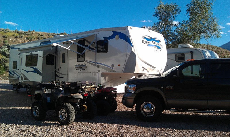
On June 16-18th, my 13 year old son and I departed South Jordan en route to Marysvale. In tow, we had our massive 42' 5th wheel, two quads and my mountain bike. We were intent on participating in the Take Back Utah event at Lizzie and Charlies RV park.
We arrived Wed. early afternoon (after a nice lunch at Hoovers), staged the RV (can't camp without Satellite TV, XBOX360, Air conditionining, 50amp power and ice cubes!) and called it a day.
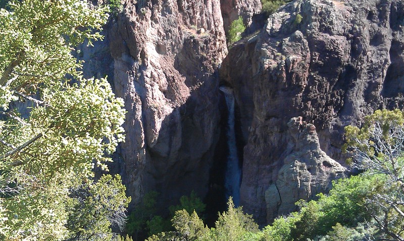
On Thursday, we met with the TBU group and initially participated in the ride up to Bullion Falls and Monroe Mountain. After eating dirt & dust for a few miles, we (my son, myself and Gary Eli) decided to leave the group and seek out our own adventure. Our destination: Koosharem via the 53 and 33 Paiute trails (some of the most Black Diamond rated trails in the area).
Considering we've ridden this area in years past without issue, we went with our normal half-day gear (wet weather, lunch, drinks). Normally, Marysvale to Koosharem is a 4 hour round trip. This day, it turned out to be a 9am-midnight adventure.
Why was it adventure? Let me tell you our story:
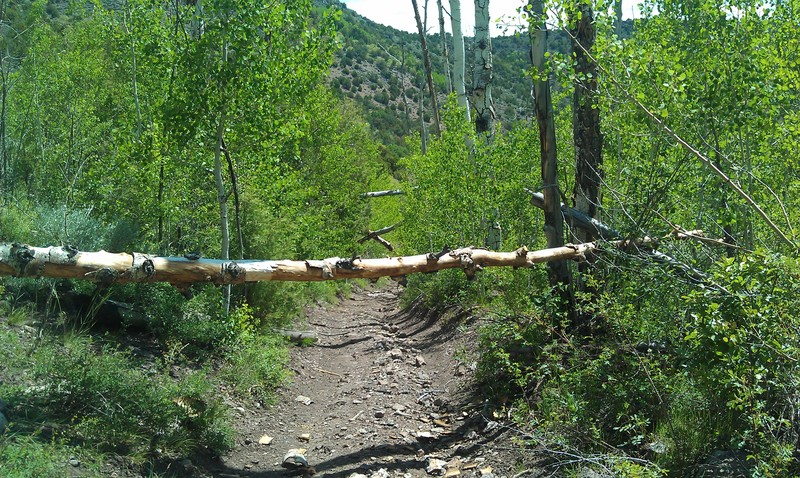
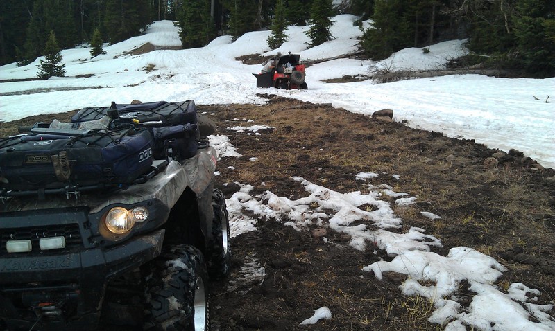
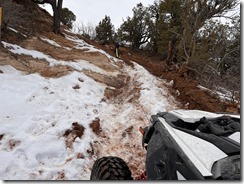
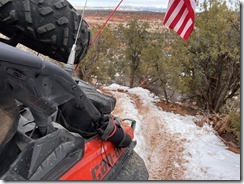
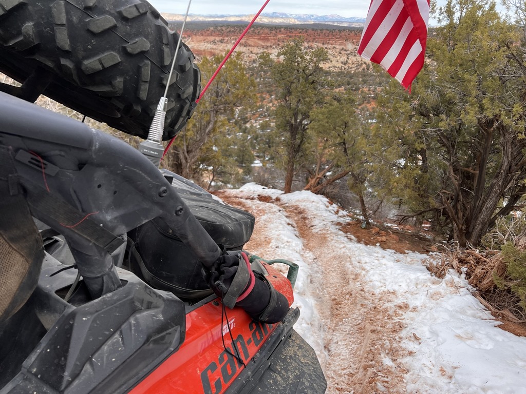
The ride up the Paiute 01 and 02 can be done in a truck; That was our initial trail up the mountain. Upon reaching 7000' elevation, we started to encounter many trails blocked by either downed trees or a combination of massive snow drifts and downed trees. Our only available trails to Koosharem were the 53 and 33. Did I mention Black Diamond rated? (BD=Extremely difficult).
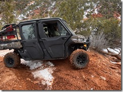
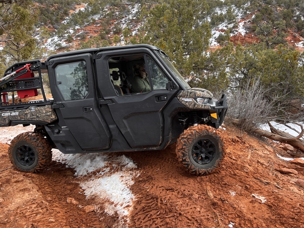
Gary was in a Razr SxS while my 13 year old was in a 2wd Honda Rancher.
Both trails were not easily accessed due to the amount of trees that had fallen over the trail. We spent a considerable amount of time cutting the trees back. I initially used my trusty handsaw (never leave without it) until Gary came clean that he brought a battery powered Sawz-All. What a relief!
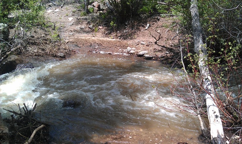
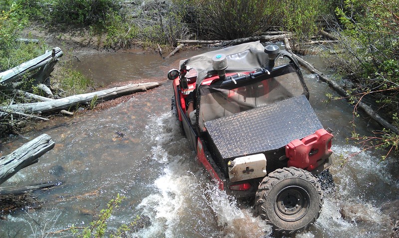
About 1/2 way up the mountain, we encountered our first creek crossing. Was the creek ever moving and deep. After gauging depth, we determined that creek was 2-3'. Probably not safe to cross without either taking water into the intake or having a machine pushed-over on its side. I decided to toss my winch cable across, get across the creek via a fallen tree and hook up the winch cable.
Without fail, a few feet into the creek, I found a hole and the front-end of the quad sunk to the front-rack. Quick action on the winch and throttle popped me out before I ingested water into the machines intake.
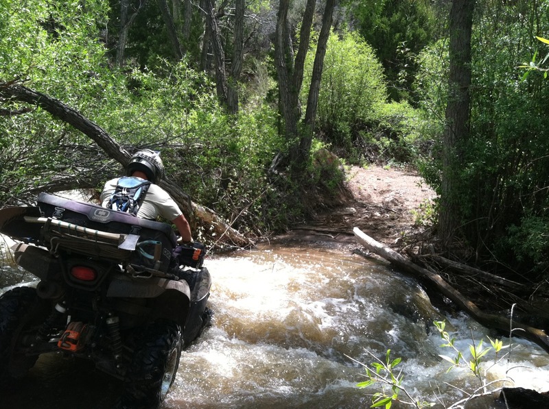
Upon arrival on the other side, I reversed the winch process and connected to Nick's 2wd Honda. He clearly didn't want to ride it across, so I tried to pull it across with the winch without a passenger. The power of the creek tried to tip the ATV over, so I quickly jumped into the creek to stabilize the machine. Water was rushing over the top of the quad, so I had to react quickly by shutting the machine off (to minimize any damage to the motor). We got the Honda across and repeated the process with the massive Razr.
Other than fouled plugs, no harm or damage was sustained! (WHEW!).
This creek crossing process was repeated a few times while trying to make our way down the mountain.
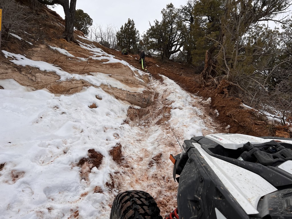
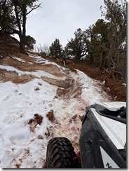
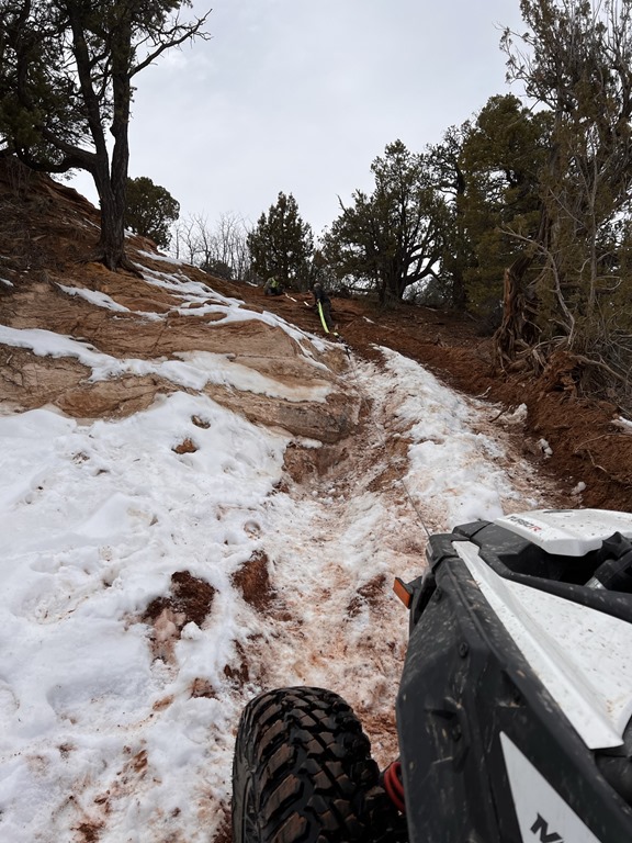
Near the top (9800'), we encountered a trail junction: Monroe or Koosharem. The sun was going down and the trail we wanted to take was buried by a massive snow drift. Nick egged me on to try the snow-packed trail. I made it 30' into the snow drift before becoming high-centered and stuck. Gary decided he could get his machine in to assist, but also got stuck. Unfortunately, there was nothing close-by to winch to. After combining my 50' winch cable, my extra 50' nylon-coated winch cable, my 12' tow strap, Nicks 8' tow strap and a hand-winch from Gary, we were able to reach the sign post. Our fear was that we'd yank the sign out. We were grateful the USFS sunk and cemented those posts in well, because it got my machine free. In turn, I was able to winch Gary's Razr out. Another hour lost on the mountain.
By now, it was nearly 5pm. Where did those hours go? Hmm.. cutting down trees, playing in the snow.. they all added up.
Shortly after extracting ourselves from the snow, we noticed the sky was becoming increasingly black and overcast. Temperatures had dropped 30-40F and the wind was picking up.
By now, we were thinking about an exit strategy and abandoning our route to Koosharem. Unfortunately, all other routes except the Black Diamond rated 33 and 53 trails were not accessible. The safe play was to get closer to civilization. Down the mountain we continued.
We finally reached Koosharem at ~6pm. The gas station and Cafe' were still open. Gary (being diabetic) needed food in order for us to continue. As we dined on burgers and corn-dogs, the storm started raging outside. Winds were easily 60+ mph with raging rain. Temps continued to plummet.
I had no cell service, but Nick's iPhone4g had some ability to dial out. I phoned the wife and put her on standby and to start contacting Flat-bed tow truck companies in Richfield in the event we couldn't make the ~60 mile trek back to camp.
We made two night attempts back up the mountain in driving rain & wind. Unfortunately, our visibility was so low, we constantly missed the trail we needed to take. Back down to Koosharem we went. As luck should have it, the gas station owner was just closing, but allowed us inside while the tow truck arrived (ALWAYS have a PLAN B). By ~10pm, we were loaded up on the two truck and en route to Marysvale. By midnight we were unloaded and back at camp.
Quite an interesting day.. and I'd do it again without hesitation!

We arrived Wed. early afternoon (after a nice lunch at Hoovers), staged the RV (can't camp without Satellite TV, XBOX360, Air conditionining, 50amp power and ice cubes!) and called it a day.
On Thursday, we met with the TBU group and initially participated in the ride up to Bullion Falls and Monroe Mountain. After eating dirt & dust for a few miles, we (my son, myself and Gary Eli) decided to leave the group and seek out our own adventure. Our destination: Koosharem via the 53 and 33 Paiute trails (some of the most Black Diamond rated trails in the area).
Considering we've ridden this area in years past without issue, we went with our normal half-day gear (wet weather, lunch, drinks). Normally, Marysvale to Koosharem is a 4 hour round trip. This day, it turned out to be a 9am-midnight adventure.
Why was it adventure? Let me tell you our story:
The ride up the Paiute 01 and 02 can be done in a truck; That was our initial trail up the mountain. Upon reaching 7000' elevation, we started to encounter many trails blocked by either downed trees or a combination of massive snow drifts and downed trees. Our only available trails to Koosharem were the 53 and 33. Did I mention Black Diamond rated? (BD=Extremely difficult).
Gary was in a Razr SxS while my 13 year old was in a 2wd Honda Rancher.
Both trails were not easily accessed due to the amount of trees that had fallen over the trail. We spent a considerable amount of time cutting the trees back. I initially used my trusty handsaw (never leave without it) until Gary came clean that he brought a battery powered Sawz-All. What a relief!
About 1/2 way up the mountain, we encountered our first creek crossing. Was the creek ever moving and deep. After gauging depth, we determined that creek was 2-3'. Probably not safe to cross without either taking water into the intake or having a machine pushed-over on its side. I decided to toss my winch cable across, get across the creek via a fallen tree and hook up the winch cable.
Without fail, a few feet into the creek, I found a hole and the front-end of the quad sunk to the front-rack. Quick action on the winch and throttle popped me out before I ingested water into the machines intake.
Upon arrival on the other side, I reversed the winch process and connected to Nick's 2wd Honda. He clearly didn't want to ride it across, so I tried to pull it across with the winch without a passenger. The power of the creek tried to tip the ATV over, so I quickly jumped into the creek to stabilize the machine. Water was rushing over the top of the quad, so I had to react quickly by shutting the machine off (to minimize any damage to the motor). We got the Honda across and repeated the process with the massive Razr.
Other than fouled plugs, no harm or damage was sustained! (WHEW!).
This creek crossing process was repeated a few times while trying to make our way down the mountain.
Near the top (9800'), we encountered a trail junction: Monroe or Koosharem. The sun was going down and the trail we wanted to take was buried by a massive snow drift. Nick egged me on to try the snow-packed trail. I made it 30' into the snow drift before becoming high-centered and stuck. Gary decided he could get his machine in to assist, but also got stuck. Unfortunately, there was nothing close-by to winch to. After combining my 50' winch cable, my extra 50' nylon-coated winch cable, my 12' tow strap, Nicks 8' tow strap and a hand-winch from Gary, we were able to reach the sign post. Our fear was that we'd yank the sign out. We were grateful the USFS sunk and cemented those posts in well, because it got my machine free. In turn, I was able to winch Gary's Razr out. Another hour lost on the mountain.
By now, it was nearly 5pm. Where did those hours go? Hmm.. cutting down trees, playing in the snow.. they all added up.
Shortly after extracting ourselves from the snow, we noticed the sky was becoming increasingly black and overcast. Temperatures had dropped 30-40F and the wind was picking up.
By now, we were thinking about an exit strategy and abandoning our route to Koosharem. Unfortunately, all other routes except the Black Diamond rated 33 and 53 trails were not accessible. The safe play was to get closer to civilization. Down the mountain we continued.
We finally reached Koosharem at ~6pm. The gas station and Cafe' were still open. Gary (being diabetic) needed food in order for us to continue. As we dined on burgers and corn-dogs, the storm started raging outside. Winds were easily 60+ mph with raging rain. Temps continued to plummet.
I had no cell service, but Nick's iPhone4g had some ability to dial out. I phoned the wife and put her on standby and to start contacting Flat-bed tow truck companies in Richfield in the event we couldn't make the ~60 mile trek back to camp.
We made two night attempts back up the mountain in driving rain & wind. Unfortunately, our visibility was so low, we constantly missed the trail we needed to take. Back down to Koosharem we went. As luck should have it, the gas station owner was just closing, but allowed us inside while the tow truck arrived (ALWAYS have a PLAN B). By ~10pm, we were loaded up on the two truck and en route to Marysvale. By midnight we were unloaded and back at camp.
Quite an interesting day.. and I'd do it again without hesitation!

Leave a comment